

22.5" x 27.5" heavy paper |
|
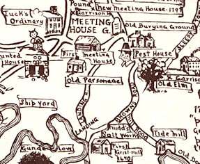
detail |
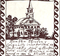
detail |
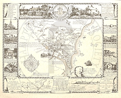
Price - $15.00This map, printed on heavy matte paper, shows a map of Hampton in the center with labels for various historic locations in town. Around the periphery are boxes with drawings and text about various points of interest, such as the salt marshes, the Grist Mill, Hotel Whittier, etc. Note that the HHS logo watermark is not on the actual map you purchase. This map is suitable for framing and looks great on a wall! For researchers, this map points out “labeled” areas in the same terms used in many old deeds:
Purchase online via PayPal (Note - you do not have to be a member of PayPal (or join it) to use this facility)Note: online sales and shipping limited to Domestic (USA) customers only Please select a quantity via the pull-down, and click the Add to Cart button
|
|