|
This page presents various historical maps related to Hampton and surrounding areas. Click the small maps to go to the particular page.
Some of the maps are intended for printing. For more information about saving images on this website to your harddrive and then printing them, click here. Do not use your browser to print these images. |
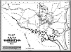
 Hi-Res 1910 Map of USA
This is a high-resolution 1910 map of the United States. The 5ft x 7ft map has been photographed in sections and each section has a lot of detail for a full map of the country. |
 Hi-Res 1638 Map of Meeting House Green Area
A high-resolution historical map of the old center of Hampton (1638), suitable for printing. |
 Hi-Res 1638 Map of Hampton Area
A high-resolution historical map of Hampton area (1638), suitable for printing. |
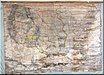
 Original Map of Hampton, circa 1830
A high-resolution view of the newly acquired map of Hampton. |
 Hi-Res 1841 Map of Hampton
A high-resolution historical map of Hampton (1841), suitable for printing. Shows many more historical houses than the 1638 map (below). |
 Hi-Res 1892 Map of Hampton
A high-resolution historical map of Hampton (1892), suitable for printing. Includes detailed view of Hampton Beach houses. |
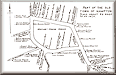
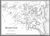
 Hampton's Historic Ring
A Walking/Riding Tour of Hampton’s Old Town Center, showing the historic locations of houses and other buildings. |
 Detailed Maps of Places in Hampton
There are many places in Hampton that have "names" (e.g. Ruth Stimson Park), but can be difficult to find on commercial maps. The purpose of the maps presented here is to help users locate such places. These are current-day maps, not historical maps. |
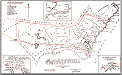
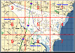
 Seacoast Trolley Routes, 1919
A map showing the routes taken by the Exeter, Hampton, and Amesbury Street Car line in 1919. |
|
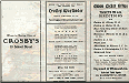
Trolley Routes In New England A colorful map from 1904 showing a "BirdEye View" of Trolley Routes in New England. This map is on display at the Tuck Museum. A print of it is on sale in the Prints From the HHS collection in the Museum Store. |
||

map |

map cover |
map back |